Our office has nearly 30 years of experience in preparing technical photo interpretation reports and expert assessments for court use, in cases involving:
- Diachronic documentation of land parcels (vegetation, ground cover, land use)
- Determination of the construction year of unauthorized buildings or additions
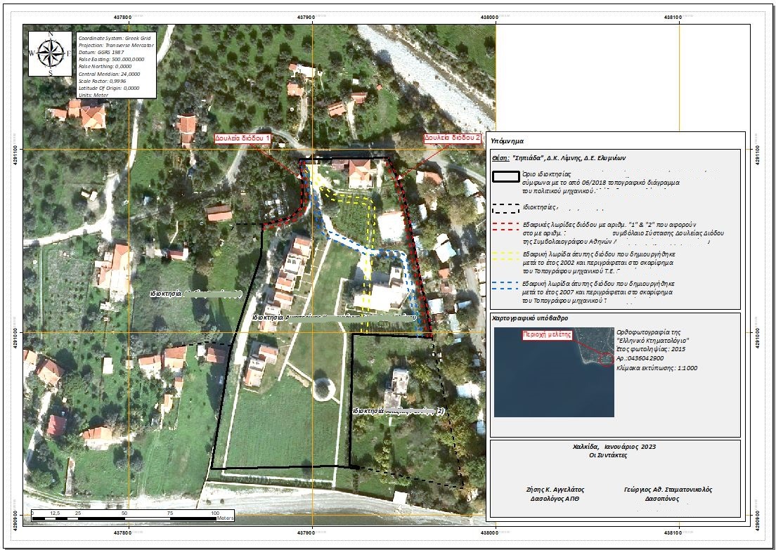
- Verification (or not) of a right-of-way easement
- Existence of roads or footpaths
- Changes in plot boundaries
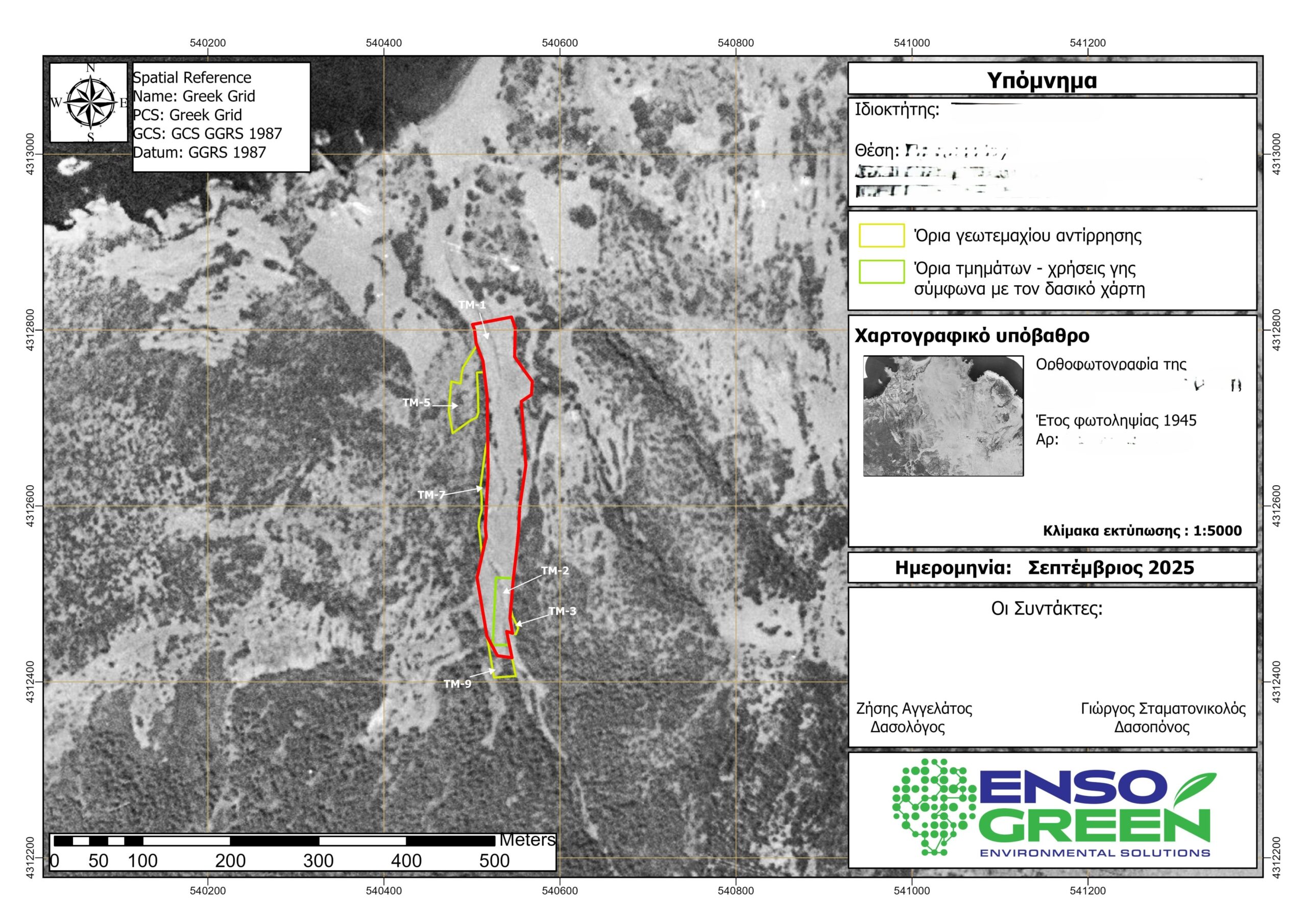
- Stream locations and their changes over time
Our scientific expertise in photogrammetry and Geographic Information Systems (GIS) ensures reliable, well-documented, and objective interpretation of aerial photographs, suitable for use in both judicial and administrative contexts.
Modern documentation tools
ENSOGREEN leverages modern photogrammetry and geospatial analysis tools, such as the eBee X (a fixed-wing drone) for large-scale aerial surveys, DJI quadcopters for targeted captures, and specialized software including ArcGIS Pro and Pix4Dmapper, ensuring high accuracy, diachronic comparison, and complete technical documentation.
The methods we use include:
- Stereoscopic photogrammetry
Through stereoscopic observation, we are able to identify terrain relief, elevation differences, and the heights of trees and buildings. This allows us to extract useful information about vegetation type, tree height, crown morphology, and more.
- Digital photogrammetry
In this case, we digitize all available data (e.g., aerial photographs, older topographic plans, etc.). We then process the data using specialized photogrammetry software, with the objective of identifying changes that may have occurred from the earlier to the most recent capture.
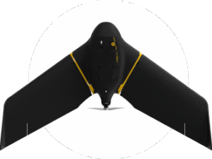
At EnsoGreen, we take our services to the next level by adding the eBee X to our equipment—one of the world’s leading drones for professional photogrammetry. With fully automated flight operation and a dedicated photogrammetry camera that changes orientation during flight, it enables automated production of photogrammetric outputs in real time.
Long-standing collaborations with:
- Law firms
- Engineering firms
- Independent engineers