Protecting your real property can no longer rely on assumptions or uncertain testimony. In modern legal disputes and forest map objections, a well-prepared photointerpretation technical report is not just a document; it is the key that unlocks justice.
But how can you ensure that your legal representative has an irrefutable piece of evidence in hand? The answer lies in the combination of cutting-edge technology and deep forestry expertise, capable of “unlocking” the court’s decision.
The Weight of Evidence: The New Legal Landscape at the Supreme Court
The case law of the Supreme Court has established new, stricter standards. Specifically, according to Supreme Court decision 1598/2025, photointerpretation has been elevated to the highest form of evidence for proving possession and property boundaries.
In the Court’s reasoning, the analysis of aerial photographs from the years 1986, 2011, and 2012 was used for the precise delimitation of plots, rejecting opposing claims. This establishes scientific photointerpretation as superior evidence compared to oral testimony.
Expert Tip: As a property owner or lawyer, your primary concern is indisputable documentation. Proving agricultural land use prior to 1960 or the existence of buildings before 1955 is the “key” to preventing the classification of land as forest. This is where we step in: the specialized forestry and environmental judicial expert report we prepare becomes the strongest tool in the hands of your legal team.
The Importance of Time Series (HAGS) for Property Boundaries
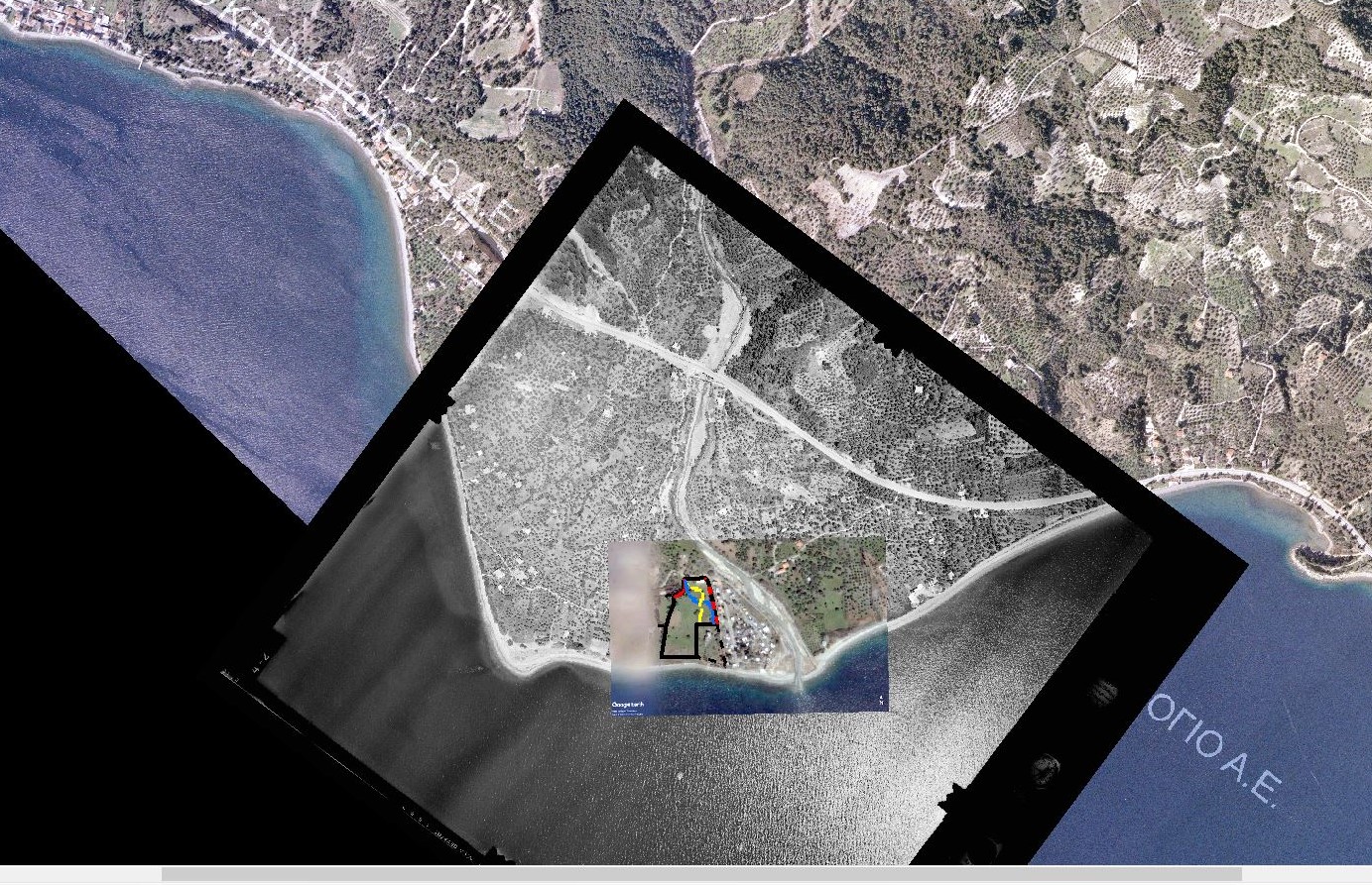
To document long-term land use and property boundaries without error, the analysis must refer to the appropriate sources.
- HAGS & OKXE Archives: We make use of the historical aerial photograph archives of the Hellenic Army Geographical Service (HAGS) and OKXE.
- Critical Dates: We strategically examine imagery from 1945, 1960, and 1980, providing the necessary long-term perspective for vegetation classification and land-use analysis.
Technological Accuracy: Combining 2D and 3D Photointerpretation
Modern photointerpretation at Ensogreen is based on the use of all available aerial image analysis methods, ensuring the scientific validity of your data.
Depending on the requirements of each case, we use:
- Two-Dimensional (2D) Observation: Allows for the rapid and diachronic identification of forms, land uses, and the basic characteristics of the landscape.
- Three-Dimensional (3D) Stereoscopic Analysis: Through specialized photogrammetry software, it provides a complete understanding of the actual terrain relief.
The use of these technologies contributes decisively to the estimation of height of natural or artificial elements and the reliable distinction between forest and agricultural vegetation. This technical precision gives our report unquestionable scientific authority, strengthening your legal representation before the Cadastre or in the courtroom.
Are you facing an issue with forest maps or the Cadastre?
Contact us today for a free initial assessment of your case.