In the management of a quarry or a large construction site, information is the most valuable asset, as every cubic meter that is not properly recorded translates into lost revenue. The accurate determination of stockpiles is not a routine measurement; it is the foundation for proper pricing, strict accounting control, and the strategic planning of your production.
Traditional surveying methods often prove time-consuming and can put personnel safety at risk. At Ensogreen, we overcome these obstacles by leveraging aerial photogrammetry and the technology of the eBee X, offering a solution with speed and surgical precision.
Digital Surface Models (DSM): The “Digital Twin” of Your Quarry
Photogrammetry makes it possible to transform hundreds of high-resolution aerial images into an accurate digital replica of the site. Using specialized software, we create Digital Surface Models (DSM) that capture every rise and depression of the terrain in centimeter-level detail.
Why does this technology change the game?
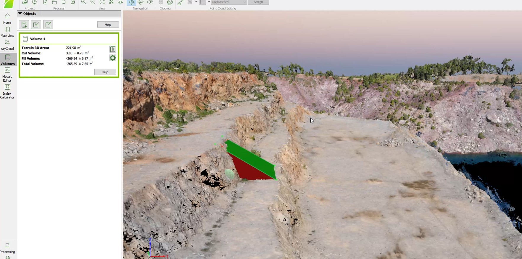
- Stockpile Accuracy: We calculate the volume of material piles regardless of their shape, eliminating the errors of approximate field measurements.
- Excavation Monitoring: We compare models from different time periods and determine precisely the quantity of material that has been extracted.
- Safety: Data collection is carried out from the air. We eliminate the need for technicians to climb hazardous slopes or unstable material stockpiles.
Technical Deliverables: Information Ready for Decision-Making
At Ensogreen, we do not deliver simple images. We provide complete geospatial products that can be directly integrated into your engineers’ workflow:
- Point Cloud: A three-dimensional set of millions of points with X, Y, Z coordinates, serving as the foundation for any volumetric analysis.
- High-Resolution Orthomosaics: Georeferenced images that allow distance and area measurements directly on screen.
- 3D Mesh: A realistic three-dimensional representation of the quarry for visualization and project presentations.
- Compatibility: All files are delivered in formats compatible with leading CAD (AutoCAD) and GIS (ArcGIS, QGIS) software, ensuring continuity of information across your systems.
The Speed of the eBee X in the Service of Industry
With the fixed-wing eBee X drone, Ensogreen maps entire quarry zones in a single flight. Where ground surveying would take days, we complete data acquisition within a few hours, minimizing downtime at the quarry.
Thanks to RTK/PPK technology, we achieve absolute accuracy without the need for time-consuming ground control points (GCPs).
Why Trust Ensogreen
Volume calculation with photogrammetry requires deep expertise in geoinformatics. The Ensogreen team consists of specialists who know how to turn raw data into actionable intelligence for decision-making.
We are the strategic partner that helps quarries and construction companies optimize inventory management, reduce costs, and improve worker safety.
Do you want to gain full control over your production?
Contact us today for a presentation of our services and see how photogrammetry brings maximum precision to your projects.