In large-scale engineering projects and forest management, time and accuracy translate directly into cost. Traditional ground surveying or the use of conventional drones (multicopters) often proves inadequate when tasked with covering areas of hundreds of acres.
At Ensogreen, we invest in cutting-edge technology with the eBee X by AgEagle. This is not just another photography drone, but an advanced fixed-wing unmanned aircraft designed to deliver high-fidelity mapping data where other methods fall short.
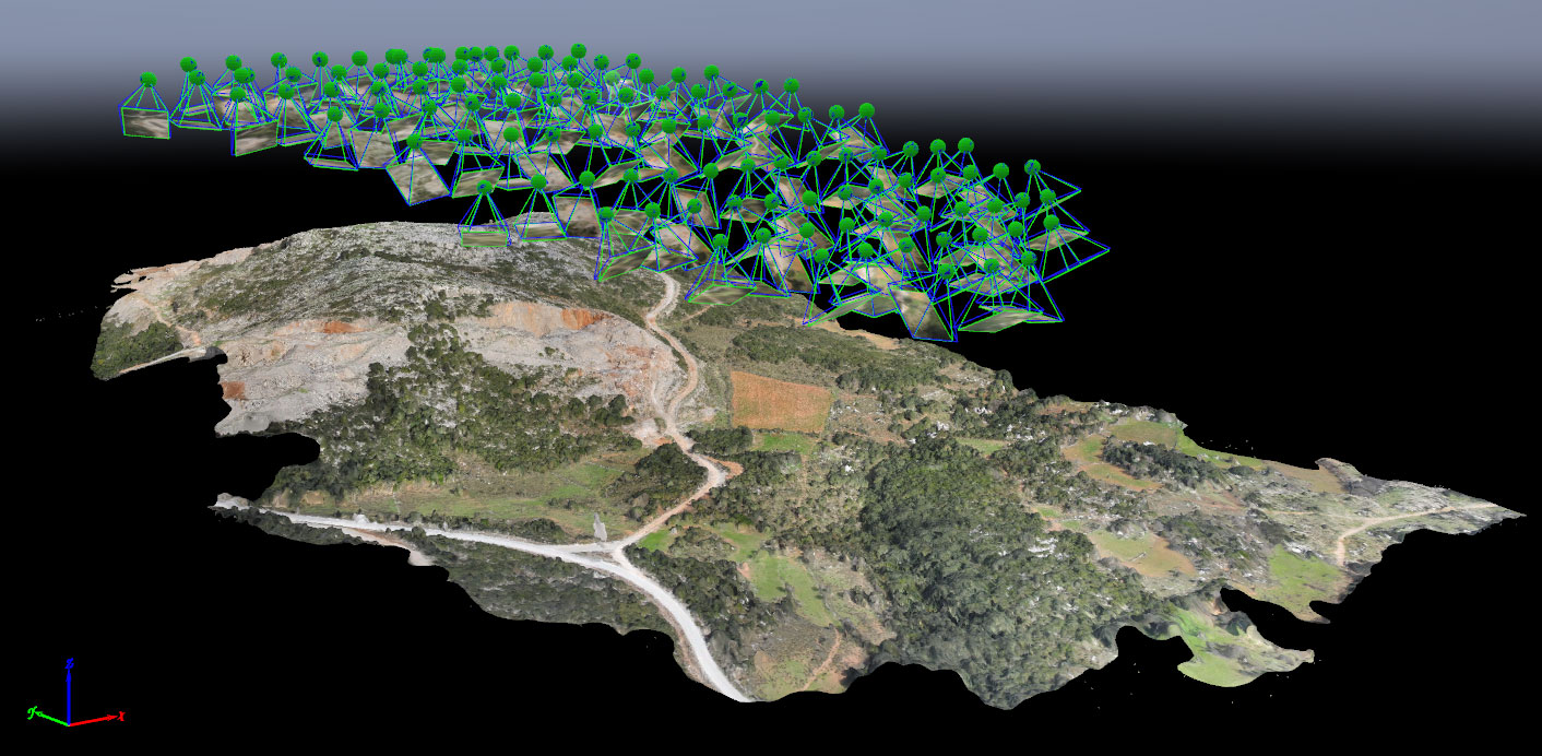
The Advantage of Fixed-Wing Technology: Coverage and Endurance Without Compromise
The main difference between the eBee X and common quadcopters lies in its aerodynamics. As a fixed-wing aircraft, it takes advantage of lift, achieving flight endurance of up to 90 minutes.
Why does this matter for a B2B client?
- Large-Scale Coverage of 5,000 Stremmas: We can cover vast areas in a single flight. Where a standard drone would require multiple battery changes and several days in the field, we complete the mission within a few hours.
- Faster Access to Data: We accelerate decision-making. In large road construction projects or forest mapping applications, the information reaches your team immediately, before field conditions change.
RTK/PPK Accuracy: Data with Surgical Precision
Drone mapping has little value if it is not backed by absolute geospatial accuracy. The eBee X integrates RTK (Real-Time Kinematic) and PPK (Post-Processed Kinematic) technologies, offering:
- Absolute Positioning Accuracy of 1.5 cm: We achieve ground positioning accuracy essential for technical studies and legal documentation based on indisputable data.
- Significant Reduction in Field Costs: The need for ground control points (GCPs) is minimized. This means less site preparation and faster project delivery, especially in inaccessible forests or quarry environments.
Applications: From Orthomosaics to Volume Calculation
Photogrammetry with the eBee X produces a wide range of digital outputs that serve as valuable tools for engineers and land managers:
- High-Resolution Orthomosaics: A fully georeferenced image of your site with detail down to just a few centimeters per pixel.
- 3D Point Clouds: Enabling three-dimensional representation of the terrain.
- Volume Calculation: In quarries or construction sites, we can calculate excavation or stockpile volumes with maximum accuracy.
- Forest Biomass Assessment: In forest management, this technology allows for biomass estimation and large-scale forest health monitoring, something impossible with ground-based methods alone.
Safety and Regulatory Compliance
At Ensogreen, flight safety is non-negotiable. The eBee X weighs just 1.6 kg, placing it among the safer drone categories. Its lightweight construction allows flights even over semi-urban areas with maximum safety, while complying with all strict HCAA and EASA regulations.
Why Trust Ensogreen
Drone mapping requires more than a skilled pilot; it demands geoinformatics specialists and forestry experts who know how to interpret the data. At Ensogreen, we combine top-tier hardware (eBee X) with the scientific expertise needed to deliver actionable information, not just images.
Whether you are an engineering company in need of precise road survey mapping or a forest management authority, our team is ready to support your needs across Greece.
Do you need large-scale mapping for your next project?
Contact us to discuss your project’s technical specifications and see how eBee X technology can improve your return on investment.